Friday, July 8, 2011

Goodaywang Wharf - Point Clare

Goodaywang Wharf at Point Clare was built in 1841 from naturally shaped sandstone obtained from the local area. Prior to the development of the road network around the Central Coast, the primary form of transport to move goods and people around the region was via the Brisbane Waters.

At low tide the general outline of the wharf is visible along with some of the larger foundation stones.
The wharf was quite large and the extant of the wharf can be seen from these photos.


This photo shows some in-situ sandstone blocks. Initially, I thought these may have been blocks from the wharf. However, after reading the description of the wharf construction on site, I believe these are an example of how the blocks were found on site prior to being used to construct the wharf.


Further Information:

Photo of Wharf c:1906 (National Library of Australia)


Sunday, June 27, 2010

Cappers Gully Quarry

 Cappers Gully Quarry is a sandstone quarry operated by Gosford Quarries sometime between 1922 and the 1950's. The site is now very overgrown but does still include some interesting artifacts. The quarry is located in Cappers Gully and is accessible from the White Street firetrail at East Gosford.

Quarry face. Visible from White Street firetrail.
Opposite face of quarry. Photo taken from head of quarry.


Base of a piece of machinery. The pieces of metal are embedded into the base and are around 40cms long. The last 5 cms are threaded. This could have been used to support the large crane required to lift and remove the large pieces of sandstone.
Large pulley wheel. One of a number of pieces of metal left at the site.
A buried piece of machinery. Part of the crane?
An example of a block blasted out of the quarry. The long grooves are the holes drilled to allow the blasting agent to be inserted into the rock.
Large cleared area with remnants of foundation structure.Water tanks are behind the clearing.
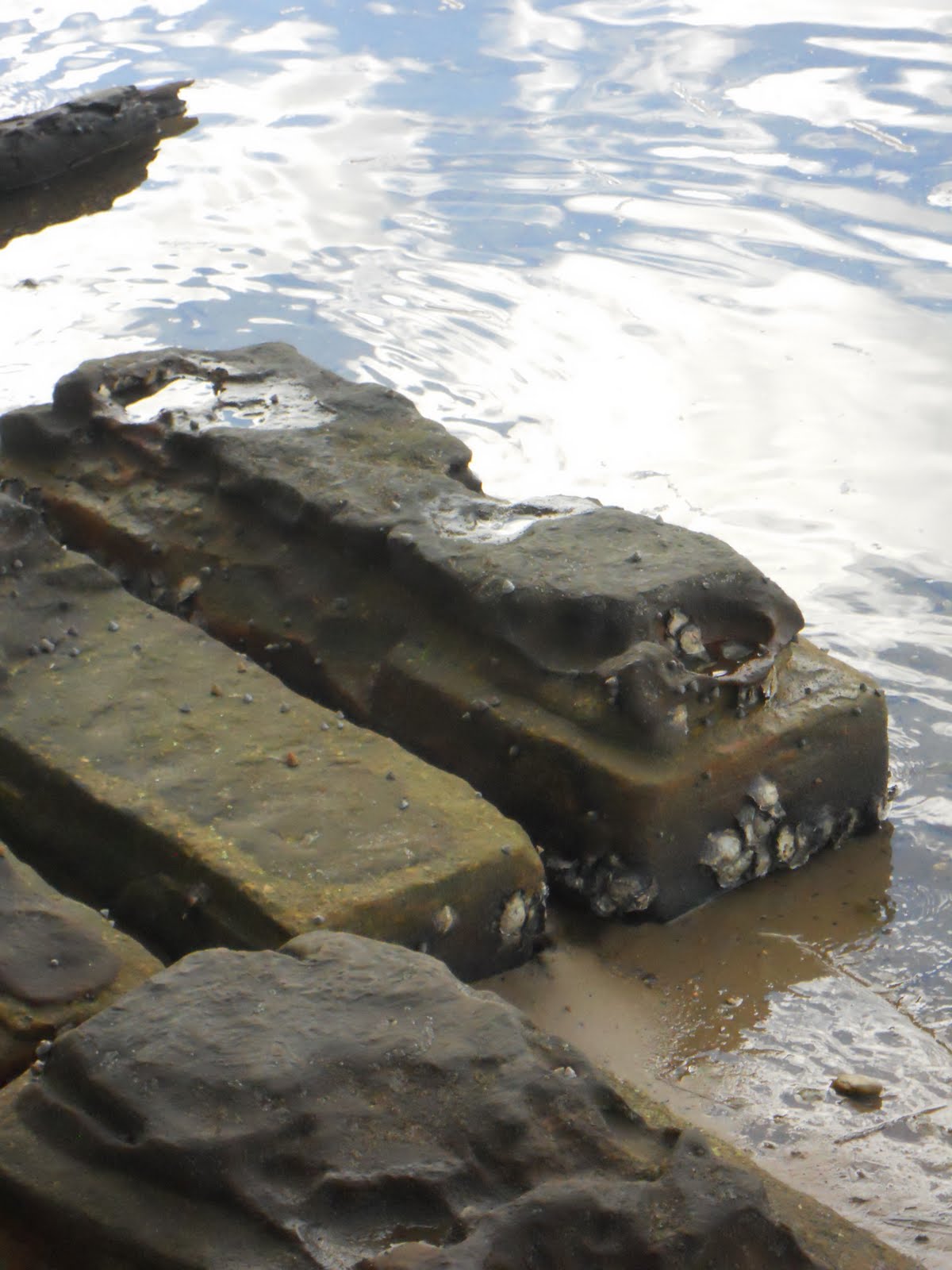
Some leftover blocks taken from the quarry. These are on the opposite creek bank. The blasting holes are visible on some of the faces.


Further Information

Geological Sites - Around Sydney- scroll down to the section about Gosford for information about the Cappers Gully Quarry.

Saturday, June 12, 2010

Upper Mangrove Cemetery

On Saturday I rode my mountain bike down to Upper Mangrove Cemetery and the location of what was once a small settlement on the first road from Sydney to Gosford.


View Upper Mangrove NSW in a larger map

To reach the settlement I rode down Dubbo Gully Road at Mangrove Mountain.This is now a service track to allow access to the catchment area of Mangrove Creek dam but was once part of the original road that allowed travelers to reach Gosford.

A overhanging rock formation close to the start of Dubbo Gully Road.


At the base of the descent the road crosses Mangrove Creek. As you follow the road around you find the Upper Mangrove Cemetery. The cemetery was part of the St Thomas' Church and until a bushfire destroyed it in 2002 the church was still situated here.

An overview of the cemetery at Upper Mangrove.
Some of the larger headstones from the cemetery at Upper Mangrove. The cemetery was still in use until around the 1950's.


Also around this area you can find evidence of the convict built nature of this road. This area is connected to the Great North Road by the Simpsons Track. It is thought that this road was built at around the same time as the Great North Road was being constructed between 1828 and 1836.

Convict built drainage culvert.


Further Photos


Further Reading:
The Convict Trail
Wildwalks - Bushwalking Information

Friday, June 11, 2010

Welcome to my Central Coast History Blog

Welcome to my blog where I will document my travels around the Central Coast looking at some of the more obscure historical sites on the Central Coast.